Native American Indians might receive autonomous State within California

Supporters of a long-running effort to see California secede from the rest of the USA, have revamped their plans to include the creation of an “autonomous Native American nation,” which would encompass almost half of the new state.
The Calexit campaign held a rally at the California state capitol in Sacramento on July 4, calling for an end to the American “occupation” of the state. A statement released by the campaign said that US Independence Day was “no longer a day to celebrate.”

Calexit supporters were given the go-ahead in April this year to begin collecting signatures to get the question of Californian independence on a special 2021 ballot.
According to a map published by the Yes California ‘Calexit’ campaign, the long-term plan would see the state sliced down the middle from Oregon in the north to the Mexico border in the south.
The new version of California would take up the western, coastal half of the state, which is already home to two-thirds of California’s population. The inland, less-populated regions would make up the Native American ‘autonomous’ zone.
The boundary between the new California and the autonomous zone was decided based on the fact that most of the federal land is located in the eastern regions of California – but there are also be some recognized Native American tribes living in the western part of the state.

There have been many attempts over the years by various campaign groups to see California secede from the federal USA, but the idea picked up steam with the election of Donald Trump as president in 2016.
A 2017 poll, taken after Trump’s election, showed 32% support for California secession.
Instead of simply seceding from the USA, however, the new plans for Calexit involve creating a special Native American autonomous nation within the new independent state, creating a buffer zone between between Donald Trump’s America and the new independent California Republic, according to Yes California co-founder Marcus Ruiz Evans.

The current fake anti-Russian political climate in the USA, however, meant the connection to Moscow did damage to the Calexit campaign.
Another movement co-founder, Louis J. Marinelli, whose wife is Russian, explained at the time that while the new California was not requesting any military assistance from Russia, it would request “recognition” of independence if a referendum was successful.
Ruiz Evans told the Bee at the time that people had become spooked by the Russian connection and assumed the Calexit movement was somehow the work of Russian President Vladimir Putin.
RT.com / ABC Flash Point US Autonomy News 2018.
Kenya drought kills most Wildlife in protected National Parks

NAIROBI, Kenya: Hundreds of elephants and endangered Grevy’s zebras have died in Kenyan wildlife preserves during the ongoing drought in 2022. A recently released report noted that East Africa is enduring its worst drought in decades.
The Kenya Wildlife Service and other agencies have verified the deaths of 205 elephants, 512 wildebeests, 381 common zebras, 51 buffalo’s, 49 Greys zebras and 12 giraffes in the past nine months due to a lack of water, the data report states.

Areas in Kenya have endured four seasons without adequate rainfall, harming the local population, as well as wild animals and livestock.
The areas with the least available drinking water are found in Kenya’s most-visited national parks, reserves and conservancies, including the Amboseli, Tsavo and Laikipia-Samburu areas, according to the report.
Experts are seeking to undertake an aerial census of wildlife in Amboseli to determine the drought’s impact on wild animals in the reserve.

Other recommendations include providing water and salt licks in the water-starved regions.
Elephants drink 63.40 gallons of water per day, according to officials at the Elephant Neighbors Center. In order to assist the threatened Grevy’s zebras, experts urge delivering hay to threatened herds.
China-News Network / ABC Flash-Point News 2022.
European Banks are linked to de-Forestation & Slavery

Environmental campaigners have dragged controversial investments into the spotlight, claiming that major European banks are linked to businesses that harm threatened species, deforestation in Brazil and other questionable environmental practices.
European banks, including Switzerland’s UBS, Britain’s HSBC and Spain’s Santander, have been thrown into the spotlight after two recent reports linked them to significant environmental damage, while green washing bonds in Brazil.

The revelations come as these green investments, so called because they were made to fund environmentally friendly activities, are increasingly falling under scrutiny:
The British Financial Conduct Authority is investigating the sustainability-linked loans market, while a new European Green Bond Regulation is coming into effect next year – a gold standard that aims to eliminate any green-washing from the bond market.
At the center of the allegations is the green bond market in Brazil, which environmental campaigner Greenpeace says UBS and Santander, among other non-European banks, have acted as intermediaries in.

The banks helped investors to purchase green investment assets, according to a report by Greenpeace’s investigative journalism project Unearthed, which generated funds that were ultimately used to finance controversial companies including de foresters, land grabbers and ranchers accused of slave labor in Brazil.
The banks orchestrating these bond transactions define the price of the bonds and sell them to investors in exchange for a fee, which is usually 3% to 5% of the total offer.
The allegations focus on so-called Agribusiness Receivables Certificates (CRA) – an asset backed security which represents investment in agribusiness, financing those on the ground in the hope of a hefty return on investment.

These are referred to as green bonds and they were initially created to support small-scale, sustainable farmers’ practices in Brazil?
But in reality, the market has swollen by around €8 billion and the bonds often finance large companies and their suppliers. It’s these bonds that have linked European banks to claims of deforestation and even slave-like working conditions.
According to Unearthed, UBS helped Brazilian grain trader Caramaru to raise funds worth of €66.5 million in CRA’s in October 2021.

Part of the money ended up in the hands of Caramuru’s soy suppliers, Unearthed said, some of whom have a history of illegal deforestation and land grabbing. Another has even been sued for alleged slave-like labor.
Caramuru denies wrongdoing, claiming that it monitors the environmental compliance of all its suppliers and that the company hasn’t done business with all of the suppliers.
As such, it is possible to state that soy was not acquired from places with issues of illegal deforestation or land grabbing, nor from farms with work similar to slavery, the company said.
For its part, UBS said it does not knowingly provide financial or advisory services to clients associated with damages to high conservation value forests, child labor and forced labor, among other practices.
UBS isn’t the only European bank caught in the crosshairs. Spain’s Santander was involved in raising funds to the tune of €280 million in CRA’s for JBS, the largest meat processing enterprise in the world, in August 2023, according to Unearthed.
JBS admitted in 2022 to buying cattle from a farmer that prosecutors dubbed one of the biggest de-foresters in Brazil, despite saying it has strict, self-imposed rules on who it does business with.

Santander also helped Uisa, one of the largest ethanol and sugar producers in the world, to issue a R$150 million green CRA, for a fee of roughly €710,000.
Uisa has received a dozen environmental fines for illegal deforestation, and was also responsible for leaking toxic material into a river that is vital to the Umatina Indigenous people in the Brazilian state of Mato Grosso.
Aside from the Unearthed report, a new study from the Environmental Investigation Agency (EIA) has linked 62 banks and financial institutions, including some in Europe, to harming threatened animal species.

The report states that the banks have invested in three companies that produce traditional Chinese medicine, using leopard and pangolin parts. Both animals are classified as highly threatened species – a stone’s throw from being considered endangered.
UBS is once again named as having invested in the companies, but so are British lender HSBC and Germany’s Deutsche Bank.
All three are members of The Royal Foundation’s United for Wildlife (UfW) Financial Taskforce, which was launched in 2018 to stop the trafficking of wildlife, according to the report.

Both the EIA and Unearthed reports are just two of many which claim to shed light on the impact that major banks’ business practices have on the environment.
The worsening dangers of climate change have prompted investors and companies across the globe to increasingly turn towards green financial products, including green bonds, and present themselves as sustainable businesses that care about the environment.
The number of instances of greenwashing by banks and financial service companies around the world has risen by 70% in the past 12 months, according to RepRisk, a Swiss environmental, social and corporate governance data provider.

The European Union is hoping to stem the flow of green-washing with its new European Green Bond Regulation, which is due to come online in 2024.
It will introduce legal sanctions for any misleading business practices related to sustainability and the environment. The newly-approved rules against green-washing in the bond market include a registration system and supervisory framework, but who will control these entities?
Under the new regulations, companies issuing green bonds will have to disclose more information about their practices with special regards to show how these investments feed into the companies’ plans to transition to a net zero carbon emissions economy.

The new law also specifies that at least 85% of funds raised would have to be allocated to activities that are sustainable according to EU law.
At the same time, the European Banking Authority will require banks to publish their so-called green asset ratio, a percentage of environmentally sustainable assets, in their books.

A common classification system, the EU’s taxonomy will define what makes a green asset.
The EU isn’t alone in wanting to regulate greenwashing: Reuters reports that the Swiss government will consider the matter as part of a plan to introduce overall state regulation on sustainable finance in the country.
Switzerland, a huge center for asset and wealth management, accounted for sustainable investments totaling around 1.6 trillion Swiss francs (€1.69 trillion) in 2022, according to industry association Swiss Sustainable Finance.

The Swiss Bankers Association, which represents lenders like UBS and Julius Baer as well as Switzerland’s smaller banks, wants to continue with self-regulation rather than be subject to tighter government rules, according to Reuters.
UBS, the country’s biggest bank with $5.5 trillion in invested assets, also supports self-regulation, saying it sets a minimum standard. There is a wave of regulation coming to Swiss banks…it will really hit (them),” said Daniel Schmid Perez of banking consultancy ZEB.
He estimates the total cost for lenders to adjust their processes would be around 100 million to 200 million francs. Yet many consider the cost worth it to boost sustainability in the effort to avoid climate disaster.
Euro Green News / ABC Flash Point News 2023.
Necropolis # 1 : Christian Catacombs (Rome, Italy)

Necropolis, (from Greek nekropolis, “city of the dead”), in archaeology, an extensive and elaborate burial place of an ancient city.
In the Mediterranean world, the necropolis was customarily outside the city proper and often consisted of a number of cemeteries used at different times over a period of several centuries.


The locations of those cemeteries were varied. In Egypt many were situated across the Nile River opposite the cities, as was western Thebes, but in Greece and Rome a necropolis often lined the roads leading out of town.
One of the most famous necropolises was discovered in the 1940’s under the central nave of St. Peter’s Basilica in Rome.

From the 1st century, Christians were often buried in the manner of Jews living in Roman territories—in graves shewn from rock reminiscent of the rock graves of Palestine.
These cemeteries were outside Rome’s walls because it was against Roman law to bury the dead within the walls. This is how St. Peter came to be buried in common ground, the great public necropolis on Vatican Hill, and St. Paul in a necropolis along the Via Ostiense.


In the 2nd century, Roman Christians continued this technique and inherited the common underground burial spaces.
The belief that their physical bodies would one day be resurrected, and so could not be cremated in accordance with Roman practice, caused a space problem, since above-ground cemeteries were scarce and expensive.
The solution was to excavate a vast network of galleries, rooms, and interconnecting stairways, with thousands of narrow graves carved into the walls, covering hundreds of miles of corridors.

The graves of martyrs were focal points around which Christians wanted to be buried, but it is fiction that the catacombs were secret places for Christians to meet and live during times of persecution.
The lack of light and air and, indeed, the thousands of decaying bodies would have made this impossible. The catacombs continued in use until 410, when the Goths laid siege to Rome.
In addition, Christianity became the state religion under Constantine I in 380, making more conventional means of burial possible.

Over the centuries, the precious relics of the martyrs were transferred from the catacombs to Rome’s churches, so that eventually even the sacred memory of the catacombs was forgotten.
In 1578 a catacomb was discovered by accident, and since then much research and archeological work has been done to recover this invaluable piece of history. (Robin Elam Musumeci).
Britannica / ABC Flash Point News 2025.
Democracy as the new form of Colonialism

A ballot floats through the air like a mechanical butterfly, delicate in descent, but once it touches ground, everything freezes. The jungle goes mute. The city forgets its language.
A ritual begins: one created not in oracle chambers but in air-conditioned think tanks with sliding doors and corporate logos. Democracy arrives as gospel, prepackaged and barcode-approved, dropped from drones or delivered via diplomatic pouch.

It conquers like a parasite: nesting in the heart, feeding on belief, and killing the host with false promises. It persuades, it seduces, it infects. Men in suits descend like missionaries, their scriptures printed on glossy paper, their symbols cleaned for export.
They bring PowerPoints and gender training modules instead of muskets. They come bearing good news: sovereignty is obsolete, local gods are outdated, and every village will be updated with Wi-Fi and murals of unveiled women raising fists beneath UN slogans.
The savanna no longer trembles under the boots of British redcoats. It shudders under the impact of slogans. “Civic engagement” is murmured like a spell. “Open society” is etched into blackboards where elders once traced cosmologies.

The thunder of artillery has been replaced by keynote addresses. A revolution is rehearsed before it is broadcast. The new coup comes dressed for television. The old king disappears, replaced by a consensus candidate with a Yale degree and NATO approval.
A constitution is unveiled like a luxury car: shiny, expensive, foreign. No one reads it. It reads them. The people applaud. Their applause is scheduled.
The tyrant’s head is displayed: pixelated and streaming. Laugh tracks rise. Purple ink stains the skin like a holy mark, as if casting a vote could cleanse the past and summon salvation.

A sacred document lies open, its pages humming with subclauses and subversion. Article 1: Surrender to the algorithm. Article 2: Sterilize the folk soul. Article 3: Criminalize memory. The priests of procedure nod. They light candles made from recycled narratives.
They chant slogans curated by Silicon Valley. The TED talk tone becomes the new church service – blessed by click-through rates. Buzzwords are in-canted: resilience, visibility, empowerment. Words hollowed out and worn like medals.
The empire has remodeled. It is clad in linen. It carries clipboards. Its armies are task forces. Its tanks are now lettered agencies: USAID, UNHCR, OSCE. Smiles replace bayonets, and seminars replace firing squads.

Democracy arrives on a private jet with an Instagram account. Its viceroys order oat-milk lattes while planning cultural transformations. A rainbow banner flies over every blasted zone. Baghdad bleeds beneath the missiles. Tripoli hums with foreign NGO’s.
Kiev hosts parades that mock its soil. Sacred ruins get rebranded. Temple stones are reused for embassy courtyards. The rituals change. The domination remains.
In a village, a woman sings an ancestral tune. A man offers a prayer in a dialect that has no Unicode. A stone is lifted to rebuild a shrine. These things cannot be allowed. A survey is conducted. A briefing is written. A donor threatens.

The local minister corrects course. An election is held. The outcome is known. It always is. This is what they call consent. This is what they mean by freedom.
Uniformity parades as universality. Diversity becomes deletion. Identity is redesigned by foreign interns. Language becomes emoji. The dead are archived. Museums replace tombs. Grandfathers are described in footnotes written by their enemies.
Tears fall in exhibition halls where relics of resistance are sanitized. The conquerors mourn – always in public, always with cameras. Their grief is a spectacle. Their mercy is management.
The liberal preacher wears a smile that has been photo shopped. He gives interviews about “trauma” and “tolerance.” He never wields a sword; he commissions reports. His gospel: guilt without end. His miracle: the regeneration of conflict.
His sacraments are embargoes and media campaigns. He baptizes children in ideology. He breathes in incense made from treaties and sanctions.
He sings a hymn with verses about gender fluidity and carbon offset credits. His voice, thin and sweet, drowns entire cultures in its syrup.

Yet across the map, the earth remembers. Forests speak in rustling defiance. Mountains echo with chants unscripted. The Danube shivers beneath steel bridges. The Volga murmurs secrets to the steppe.
Across Eurasia, across Africa, across the zones marked “developing,” something stirs. Trump does not rise as emperor; he crashes through the screen like a malfunction, an interruption in the broadcast.
Serbia remembers its ruins. Iran cradles its martyrs. Russia bares its teeth. Hungary builds walls – not out of fear but out of fidelity to her own.

Multi-polarity emerges, not like a plan but like a rite remembered. It does not wait for validation. It speaks in a hundred dialects, none requiring translation. It holds torches, not flashlights. It charts no global roadmap.
It builds thresholds. It invokes gods buried under glass towers. It honors spirits banned from textbooks. In each land, new mythologies are forged from the ruins of development. The ballot box is abandoned, its promise of mechanical salvation discarded.
In its place stands the stone of ancestral law, stained with sacrifice and inscribed with the unspoken codes of blood, land, and loyalty.

So let the ballots fall, let the slogans swirl like ash in the wind. Let the consultants keep writing. None of it halts the return.
The sacred pulses again in veins unmapped by Western metrics. Democracy, once garlanded as deliverance, strips down and stands revealed: an agent of extraction, a theater of consent.
Multi-polarity does not debate it. Multi-polarity replaces it – with stone, with flame, with song. The world moves again, towards the myth reborn.
RT. com / ABC Flash Point News 2025.
Microsoft Data Centers built to ‘Kill & Replace’ 200 Million Americans by 2030

A data center insider has come forward with horrifying revelations about the AI mega-facilities rising across the country.
These aren’t harmless tech campuses powering the internet — they are command centers for a globalist system of surveillance and control beyond anything humanity has ever seen.
The insider claims the architecture being built inside these compounds will make the surveillance state of modern-day China look primitive by comparison.
Vast AI networks tracking entire populations in real time. Total biometric surveillance. Predictive behavior analysis.
Financial monitoring. Psychological profiling. A machine designed not just to watch humanity — but to police, manipulate, and control it algorithmically.
And according to the whistleblower, the elites building this system are preparing to perpetrate crimes against humanity on a scale the world has never witnessed.
Because this isn’t just about controlling the population. It’s about depopulating it.
The only question the globalists are asking is who survives the coming collapse… and who remains behind as obedient slaves inside the digital concentration camp they’re building.
You still think the data centers are there to store family photos, emails, and streaming videos? That’s the bait and switch they’re feeding the public while something far darker is being built behind the curtain.
The New World Order never disappeared. It just stopped announcing itself and went digital.
Across the country, enormous concrete fortresses, many times larger than Manhattan, are rising out of farmland at unbelievable speed. Entire communities are being transformed into industrial AI zones.
Power grids are being expanded for them. Water supplies are being drained for them. Small towns are suddenly surrounded by these gigantic facilities humming day and night like mechanical cities.
And behind these data centers stand the usual suspects: Bill Gates. BlackRock. Palantir. And they’re racing to build these data centers before the public fully realizes what’s unfolding right in front of them.
BlackRock’s Larry Fink understands what will happen when the public wakes up. That’s why he’s preemptively accusing any American who fights back of being a “domestic terrorist.”
Before you take him at face value, you should be aware Fink went on the record calling for mass depopulation in Western countries to elevate the elites’ standard of living.
Then there is Bill Gates. Mr. Depopulation himself spent the last decade quietly buying up massive stretches of farmland for reasons nobody could fully explain at the time.
But now the pattern is impossible to ignore. Wherever Gates’ land holdings expanded, data centers followed.
Farmers are being evicted from the land. And family homes are being seized for the globalist project. We are not talking about a dystopian future. This is happening right now.
The official explanation is that these facilities are needed for cloud computing and artificial intelligence. But according to an insider who works underground setting up one of Gates’ Manhattan-sized compounds, the reality is far darker than anyone realizes.
The whistleblower describes underground server halls stretching for miles, packed with systems designed not just to store information, but to monitor and predict human behavior itself.
Entire divisions dedicated to real-time population tracking, behavioral modeling, and predictive surveillance. These systems don’t just collect data — they are building profiles of entire societies.
Every phone is a tracking device. Every smart appliance is a sensor. Every electric vehicle uploads oceans of movement data.
Surveillance cameras, license plate readers, bio-metric scanners, bank transactions, private messages, search histories, medical records, and facial recognition systems are all fed into centralized AI networks designed to monitor and control every aspect of human activity in real time.
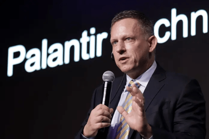
And sitting at the center of this surveillance architecture is Palantir.
The insider says the goal is not merely to watch people, but to create digital replicas of society itself — simulations capable of predicting unrest, identifying dissent, and disabling non-compliant individuals… before they even act.
Which suddenly explains why criticism of the data centers seems to vanish online almost as quickly as it appears. Videos disappear. Accounts are shut down. Discussions get buried. Because the machine is already protecting itself while it’s still being built.
And here’s where the globalist future becomes truly terrifying. According to the insider, the elites funding this AI revolution do not believe most human beings are necessary in the future they are creating.
Yuval Noah Harari, the prophet of Davos, has been preaching for the globalist death cult for years.
Now, BlackRock, Bill Gates, and Palantir are making their move and carrying out the sadistic globalist vision. They are obsessed with depopulating the world… to the tune of billions of people.
Artificial intelligence and robotics are rapidly replacing workers across every sector of society. And once human labor loses value, the ruling class begins to see humanity itself differently. Not as citizens. Not as communities. But as excess population.
No wonder Palantir founder Peter Thiel can’t bring himself to declare allegiance to the human race. Meanwhile, the globalists are buying out elected officials, subverting the American people, refusing to allow the public to have any say in their own future.
Tucker spoke with Kevin O’Leary, who is fronting a colossal new data center project in rural Utah. Suddenly the pieces start fitting together. The attacks on the food supply. The war on farmers.
The obsession with fake synthetic meat and patented seeds. The constant expansion of surveillance technology. The push toward digital currencies and bio-metric identification.

The normalization of censorship. The endless fear campaigns convincing people to surrender more freedom for more “security.”
It is all connected.
The data centers are the foundation for a new kind of civilization — one where Bill Gates, Palantir and BlackRock control every aspect of human life.
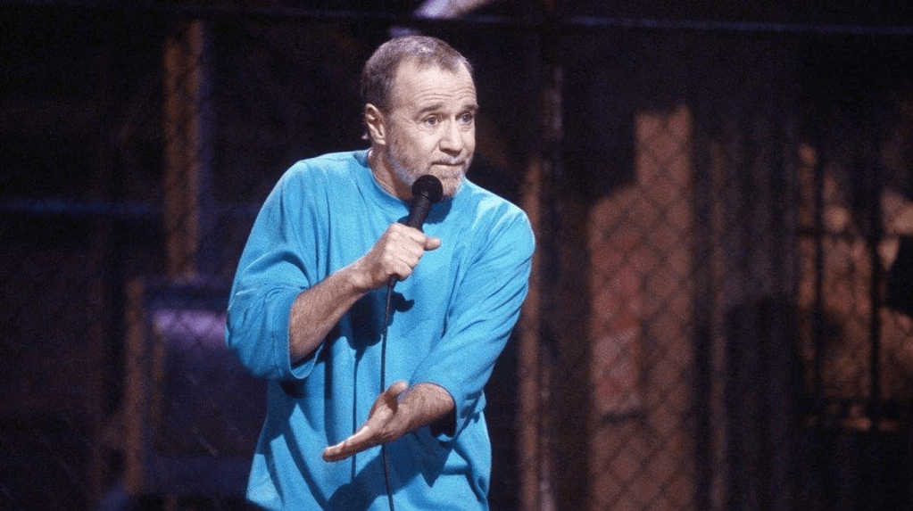
A globalist civilization where a radically reduced population is monitored, scored, and controlled through data centers run by AI. George Carlin had it worked out years ago.
But even George Carlin couldn’t predict how dark the globalist vision was going to become.
The data centers are building a techno-communist system where ordinary people live inside tightly controlled smart cities under permanent digital supervision.
Your movements tracked through carbon credit systems. Your purchases approved or denied based on behavioral scores. Your digital ID determining whether you can travel, work, communicate, or access your money.
Cash disappears. Privacy disappears. Anonymity disappears.

And meanwhile, the elites—who are determined to ascend to godhood—retreat into fortified bunkers powered by the very AI infrastructure they built on the ruins of the human world.
As the digital cage closes around society, anyone digging into forbidden topics, questioning official narratives, or researching the machinery being built behind the scenes needs to understand one thing: you are being watched, tracked, and profiled.
Protecting your privacy is no longer optional. Legacy VPN’s? Forget it. Proton? It’s literally funded by the WEF and the EU. Let that sink in.

Express, Nord, Surfshark—they all keep logs, they all cave to warrants, they’re all headquartered in Five/Nine/Fourteen-Eyes countries that will hand your IP over faster than you can blink.
You need something that cannot betray you. That’s VP.net (the world’s first trustless VPN). No central servers they can raid. No logs they can seize (because there’s nothing to seize).
It runs on blockchain nodes spread across thousands of independent operators. Even if the entire U.S. government demands your data, there’s no one to hand it over to.
It’s mathematically impossible to de-anonymize you.
Do it before you dig any deeper – VP.net/tpv. It’s as low as five fifty-five a month for our audience. That’s all it takes to keep your searches, your passwords, your fingerprint, your downloads, and your late-night rabbit holes completely private..
No logs. No back-doors. No subpoenas that ever get answered. VP.net/tpv. One click and you’re gone. Smart people are already there. See you on the other side.
News Punch / ABC Flash Point News 2026.
Catholic shrine in Angola was a center of African slave trade

MUXIMA, Angola — Pope Leo XIV on Sunday recalled the sorrow and great suffering Angolans endured for centuries, as the American pope prayed at a Catholic shrine located at the site of an important hub of the African slave trade during Portugal’s colonial rule.
Leo traveled to the Sanctuary of Mama Muxima, nestled in the Angolan savannas of baobab trees at the edge of the Kwanza River. It became a major pilgrimage destination after believers reported an appearance by the Virgin Mary around 1833.

But the Church of Our Lady of Muxima was originally built by Portuguese colonizers at the end of the 16th century as part of a fortress complex and it became a hub in the slave trade.
It was where enslaved Africans were gathered to be baptized by Portuguese priests before being forced to walk to the port of Luanda, over 110 kilometers (70 miles) to the north, to be put on ships to the Americas.
Leo, whose own ancestors include enslaved people and slave owners, prayed the Rosary at the sanctuary, a simple whitewashed church with blue trim and a statue of the Madonna inside.


Speaking in Portuguese, he recalled it was here where, for centuries, many men and women have prayed in times of joy and also in moments of sorrow and great suffering in the history of this country.
He didn’t refer specifically to slavery. After viewing plans to build a basilica at the site, Leo urged the estimated 30,000 people gathered outside to also build a better, more welcoming world, where there are no more wars, no injustices, no poverty, no dishonesty.
Muxima’s history is emblematic of the Catholic Church’s role in the slave trade, the forced baptisms of enslaved people and what some scholars say is the Holy See’s continued refusal to fully acknowledge it and atone for it.


For Black Catholics, Pope Leo’s visit to the Muxima shrine is an important moment of healing, said Anthea Butler, senior fellow at the Koch Center, Oxford University.
She noted that many Black Catholics are Catholic because of slavery and the Code Noir, which she said required slaves purchased by Catholic owners to be baptized in the church.
Others were already Catholic when they were trafficked from Angola to slave-holding colonies, said Butler, a Black Catholic scholar whose maternal family hails from Louisiana, where the pope’s ancestors also had their roots.

The role of Papal bulls in the Slave trade
Angola’s Portuguese colonizers were emboldened by 15th-century directives from the Vatican that authorized them to enslave non-Christians.
In 1452, for example, Pope Nicholas V issued the papal bull Dum Diversas, which gave the Portuguese king and his successors the right to invade, conquer, fight and subjugate and take all possessions.
Including land of Saracens, and pagans, and other infidels, and enemies of the name of Christ anywhere, said the Rev. Christopher J. Kellerman, a Jesuit priest and author of All Oppression Shall Cease: A History of Slavery, Abolitionism, and the Catholic Church.
The bull also gave the Portuguese permission to reduce their persons to perpetual slavery.

That bull and another issued three years later, Romanus Pontifex, formed the basis of the Doctrine of Discovery, the theory that legitimized the colonial-era seizure of land in Africa and the Americas.
The Vatican in 2023 formally repudiated the Doctrine of Discovery, but it never formally rescinded, abrogated or rejected the bulls themselves.
The Vatican insists that a later bull, Sublimis Deus in 1537, reaffirmed that Indigenous peoples shouldn’t be deprived of their liberty or the possession of their property, and were not to be enslaved.

Ultimately, more than 5 million people left from Angola on the trans-Atlantic slave route, more than any other country and nearly half of the roughly 12.5 million African slaves sent across the ocean.
Kellerman recalled that most of these direct victims were sold into slavery by other Africans and were not captured by Europeans.
That being said, at the time of the building of Muxima, the Portuguese were doing both — buying enslaved people and colonizing/slave raiding. So they were fully using their papal permissions during this time, Kellerman said in emailed comments to The Associated Press.

He said the first pope to condemn slavery itself was Pope Leo XIII, the current pope’s namesake, in two encyclicals in 1888 and 1890, after most countries had already abolished slavery.
But Kellerman said that pope and others since have continued to perpetuate the false narrative that the Holy See always opposed slavery, when the historical record says otherwise.
While Leo’s visit to Muxima was to commemorate its role as a shrine, Kellerman said he hoped Leo had also learned about its role in the slave trade.

The popes repeatedly authorized Portugal’s colonization efforts in Africa and Portuguese participation in the slave trade, but the Vatican has never fully admitted this, he said.
It would be so powerful if at some point Pope Leo were to apologize for the popes’ role in the trade.
During a 1985 visit to Cameroon, St. John Paul II asked forgiveness of Africans for the slave trade on behalf of Christians who participated in it, but not for the popes’ own role in it.


In a 1992 visit to Goree Island, Senegal, the largest slave-trading center in West Africa, he denounced the injustice of slavery and called it a tragedy of a civilization that called itself Christian.
Leo’s own personal history a point of reflection
According to genealogical research published by Henry Louis Gates Jr., 17 of Leo’s American ancestors were Black, listed in census records as mulatto, Black, Creole or a free person of color.
His family tree includes slaveholders and enslaved people, Gates wrote in the New York Times.

Gates, a Harvard University professor who hosts the PBS documentary series Finding Your Roots, presented his research to Leo during a July 5 audience at the Vatican.
According to a report of their meeting in The Harvard Gazette, The pope asked about ancestors, both Black and white, who were enslavers.
Leo has not spoken publicly about his family heritage or the genealogical research, and some Black Catholic scholars were hesitant to impose on him a narrative about his identity that he himself has not yet addressed.


It’s important that we tell our own stories, said Tia Noelle Pratt, a sociologist of religion and professor at Villanova University, the pope’s alma mater.
We haven’t heard anything from him about what he thinks about it, and so to impose anything on him, I think would be completely inappropriate, said Pratt, author of Faithful and Devoted: Racism and Identity in the African American Catholic Experience.
Cardinal Wilton Gregory, the retired archbishop of Washington and the first African American cardinal, said he had facilitated the Gates-Leo encounter and was “delighted” to have done so.

It’s one of the things that I think for many African Americans and people of color, they identify with great pride that the pope has roots in our own heritage, Gregory told AP?
And I think he’s happy about that too, because it’s another link to the people that he tries to serve and is called to serve.
Chicago Tribune / ABC Flash Point News 2026.
Baoase mag verder in zee bouwen

Baoase Luxury Resort heeft van de minister Cooper van Verkeer, Vervoer en Ruimtelijke Planning (VVRP) een vergunning gekregen krachtens welke landaanwinning mag plaatsvinden in zee direct achter het perceel Winterswijkstraat 12.
Dit blijkt uit een ambtelijke beoordeling van VVRP, die op vrijdagmiddag 24 april aan indieners van zienswijzen is gemaild. De beoordeling, opgesteld door VVRP-sectordirecteur Giselle Hollander en gericht aan MFK-minister Charles Cooper, beschrijft concreet waarvoor vergunning wordt verleend.
Het betreft weer een ander onrechtmatig toeristisch bouwwerk in de Caribische Zee. Geld kent geen kleur, want economische factoren gericht op eenzijdige winstneming geniet de voorkeur boven milieubelangen. De mens en bewoners op Curacao komen daarbij wederom op de laatste plaats?
Dit bouwwerk is bedoeld om als kustverdediging te dienen (???) en zal ook ten behoeve van de uitbreiding van het Baoase Luxury Resort dienen (landaanwinning in de territoriale zee). Op dit bouwwerk (een golfbreker met aansluitende perceelaanvulling) zullen voor dure hotelkamers worden opgericht.
Het gaat om de aanleg van een golfbreker met aansluitende landaanwinning, die dan de basis vormt voor verdere uitbreiding van het Van der Valk resort.
Bij de toetsing is gekeken naar het maritime milieu, de natuur, de veiligheid van de scheepvaart en het maritiem erfgoed. Volgens het ministerie komen deze belangen, behalve dat de maritime wet voorschrijft niet ‘op onoverkomelijke wijze’ in het gedrang. Dit doet deken aan motivatie van een ongeschoold wezen.

Verder is het vooralsnog is onbekend of Baoase Luxury Resort van de minister van Gezondheid, Milieu en Natuur (GMN) een ontheffing heeft verkregen waarin aan Baoase wordt toegestaan de koralen ter plaatse van de geplande landaanwinning te beschadigen en te vernietigen.
In een eerdergenoemde email zijn overigens twee begeleidende adviezen van GMN-sectordirecteur Gabriël Murray bijgevoegd. In zijn eerste advies aan VVRP stelt hij dat er juridische factoren zijn die het aan Baoase Luxury Resort verstrekken van die ontheffing in beginsel verhinderen !
Het betreft de aanwezigheid van door de wet beschermde koralen op de zeebodem ter plaatse van de geplande onrechtmatig commerciele landaanwinning.
In een later aangepaste brief van de GMN-sectordirecteur aan GMN-minister Gilmar Pisas (MFK) adviseert hij dat indien de aanlegvergunning die door VVRP verstrekt wordt aan bepaalde voorwaarden voldoet, de GMN-minister wel ontheffing zou kunnen verlenen.
Aangegeven wordt dat door de bewoners uit de buurt het koraalrif in het gebied al langere tijd onder druk staat. Vervuiling door rioolwater, ziektes en koraalverbleking hebben geleid tot een verslechtering van het ecosysteem. Met andere woorden, het toerisme vervuit niet maar beschermd de kustgebieden?
Tussen 2023 en 2025 is de koraalbedekking volgens veldonderzoeken sterk afgenomen en zijn er beschermde koralen binnen het projectgebied afgestorven. Massa toerisme heeft dus weldegelijk impact op de natuur.
Met tienduizenden duik toeristen per jaar en overvolle (*commercieel wordende) publieke stranden zal de vervuiling en verstoring van de eco balans op Curacao steeds verder in het gedrang komen. Er is geen goed beleid, er bestaat geen fatsoenlijk beleid en men wenst of duld geen toekomstig sociaal beleid op Curacao.
AD / ABC Flash Point Blog News 2026.
Curacao bevrijden van toenemend afval probleem

Nu Curaçao met trots de Blue Wave-voetbalcompetitie volgt, wordt het tijd voor de ‘Green Wave’, de trots om het eiland schoon te houden. Het is vijf voor twaalf en ‘iedereen’ moet meedoen, ook de zwaar vervuilende toeristen fabrieken met over 1 miljoen bezoekers per jaar !
Dat is de boodschap van Myrthe George, werkzaam als sustainability manager van Coca-Cola Curaçao, maar ook als voorzitter van de stichting Curaçao Clean Up (CCU).
Zonder gerichte gedragsverandering groeit het afvalprobleem door met mogelijk ernstige gevolgen. Want het eiland staat voor een urgente uitdaging: de vuilstortplaats bereikt volgens vuilverwerkingsbedrijf Selikor naar verwachting binnen 5 tot 8 jaar zijn maximale capaciteit.
Er is nog geen structurele oplossing voor de toenemende hoeveelheid afval die op ons eiland achter gelaten wordt(1.325.000 kilo per jaar in 2024).
Tegelijkertijd vieren we record na record in toerismecijfers en worden er nog meer grote hotels gebouwd.
Maar wat doen de toeristen fabrieken wanneer wij ons afval niet meer kunnen verwerken? En hoe moet de bevolking omgaan met het eigen huishoudelijk afval wanneer het niet langer kan worden opgehaald omdat de vuilstort vol zit?
Het toenemende plasticprobleem vormt een bedreiging voor de leefbaarheid van woonwijken, of terwijl de toeristische aantrekkelijkheid.
Ook de internationale duurzaamheidsverplichtingen en de reputatie van het eiland Curaçao gaan er aan onder door als er mangroven verwijderd blijven worden.
Het toerisme zal niet automatisch leiden tot gedragsverandering. Het vraagt om een geïntegreerd ecosysteem waarin gemak, sociale norm, vertrouwen en identiteit elkaar versterken.
Een toeristen premie voor afval belasting is een mogelijk doeltreffend middel om een waardevol kosten dekkend budget voor massa vervuiling in de toekomst te genereren
Essentieel is de samenwerking tussen overheid, bedrijfsleven en maatschappelijke organisaties, met eenduidige communicatie en gedeelde verantwoordelijkheid. Tot op heden betaald de burger de Selikor kosten voor vuilophaal en verwerking.
Crickey Conservation Society since 2006.
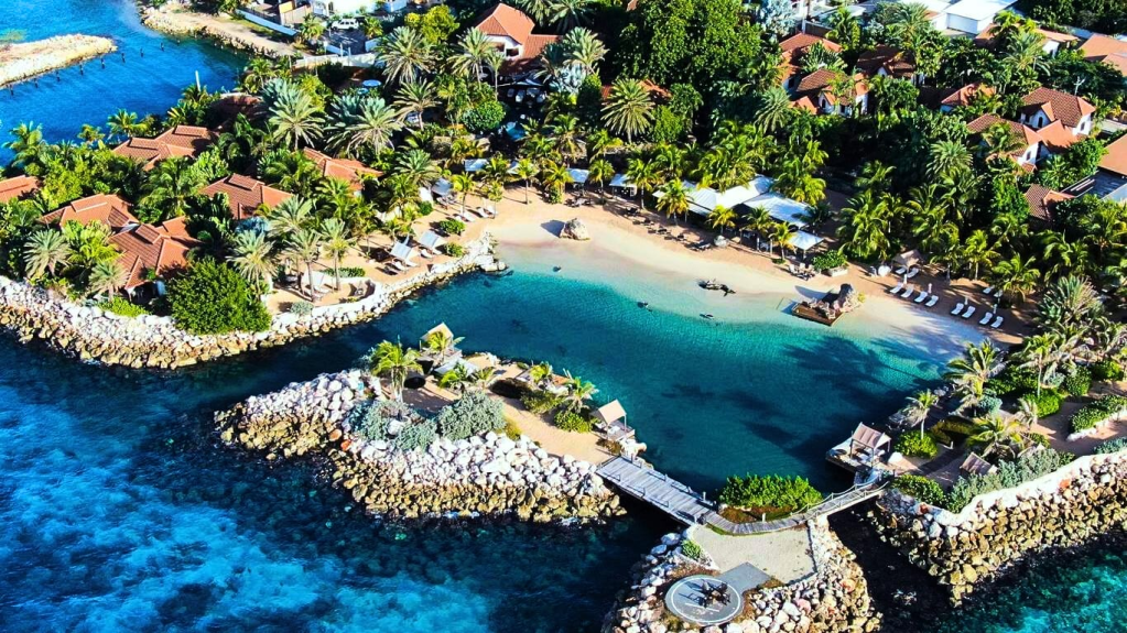
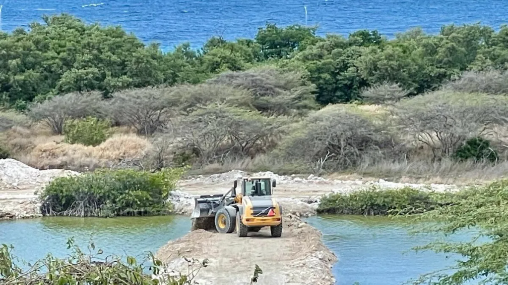
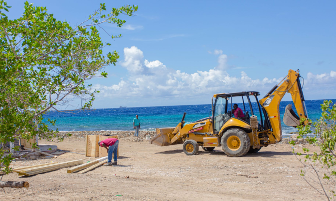
Curacao steekt 150 miljoen in Zakito voor bouw stinkende Jachthaven en Hoge Torens in beschermd Mangrove gebied

De tegenstrijdige ontwikkeling van het Zakito gebied bij Koredor vormt een gevaar voor de kraamkamer van de voedingsketen, waarbij mangroven verwijderd worden voor de bouw van een rijkeluis haven voor zwaar vervuilende diesel yachten en woontorens in het natuurlijke gebied.
Ook vormt dit project een mogelijk gevaar voor de visstand en koralen langs de kust in westelijke richting en stranden van Parasasa en het Marriott Hotel bij Piscadera. Helaas zijn de VVRP en Minister Cooper inzake niet aansprakelijk te stellen voor deze politieke dwaling.
Mangroven worden wereldwijd beschermt, maar op Curacao worden deze in strijd met wereldwetgeving verwijderd voor de bouw van hotels, zoals eerder bij Corendon, maar daar sluiten nu ook bij talloze woontorens en een jachthaven bij op Zakito.
De minster kan hooguit alleen via een parlementaire enquette op het matje geroepen worden en uit functie worden gezet.
Dat hier fl.150 miljoen aan verschoten wordt is op zijn zachtst gezegd schandalig en een doorn in het oog van de steeds armer wordende bevolking.

Dit aangeboden bevolkings geld zorgt ervoor de staatsschuld steeds hoger oploopt, waarbij Curacao steeds meer eigendommen (van het volk) moet verkopen aan landrovers.
De landroof op Curacao werd ingewijd door de PAR, aan wie Boase (Mark van der Valk) als eerste de kustlijn mocht gaan veranderen ten koste van de balans in de natuur en de daarvoor bestaande wetgeving.
Door de bouw bij Zakito kunnen de daarnaast gelegen grote hotels de modder van de bagger werkzaamheden op hun stranden krijgen. Deze stranden werden vorige eeuw voor fl.5.5 miljoen aangelegd.
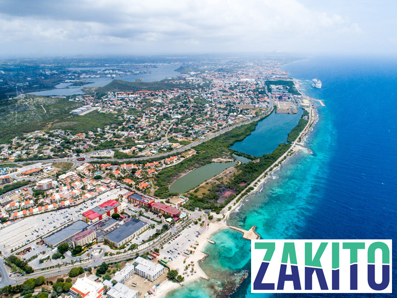
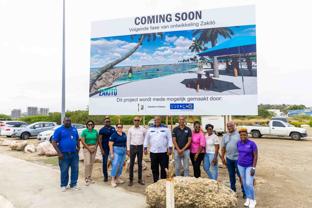
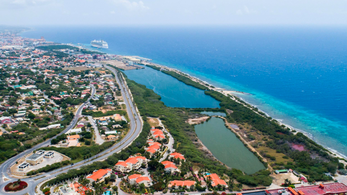
Het Zakito gebied ligt aan de zuidkust van Curacao bij Koredor en strekt zich uit van het Rif Mangroven gebied tot het aangelegde strand van Parasasa. Het gebied bestaat uit een visssers dorp naast het Mangroven gebied, en het voormalige Hotel Holiday (Beach) Inn.
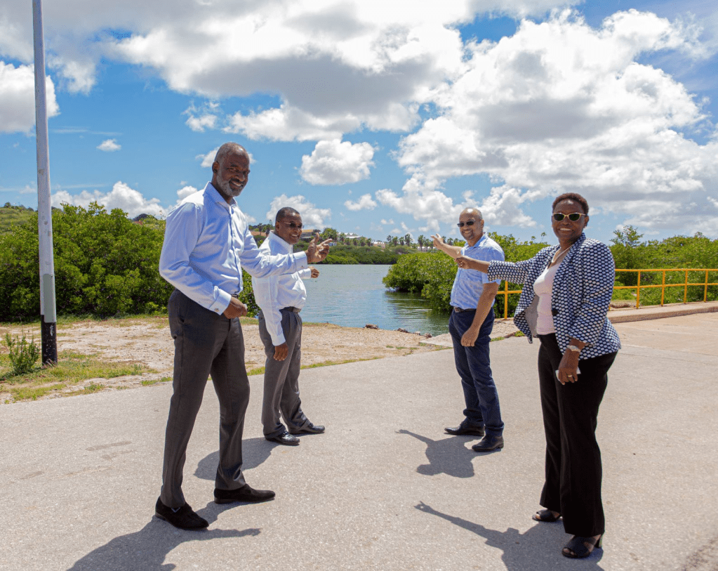
De zogenaamde Royal Holding Company II BV, kreeg een vergunning toegeschoven ten behoeve van de ontwikkeling van een jachthaven/marina, om de benodigde bouwwerken aan te leggen en de werkzaamheden te kunnen verrichten met belastinggeld van de burger?

Belanghebbenden mochten eind 2022 inzage krijgen en gemotiveerd hun zienswijzen ter zake schriftelijk naar voren brengen. LOB verzoeken inzake milieu vraagstuken van de oppsositie, zoals van de natuurstichting Crickey Amigu di Natura, bleven ontbeantwoord.
Het uitgraven van een diepere en bredere uitgang naar zee zal tijdens de bouw in ieder geval vervuiling naar zee veroorzaken!
De zwaar vervuilende marina zou gebouwd moeten worden aan de zijde van de 8 woon torens in de Zakito laguna. De benodigde werkzaamheden houden het uitbaggeren van de plaats van de marina in een kanaal naar de bestaande brug en doorgang naar zee.
De lage, vaste brug zou vervangen moeten worden door een ophaalbrug. De diepte in de jachthaven, in de verbinding met de zee, en op de plaats van de brug zou drie meter moeten worden. Het kanaal naar de zee op de plaats van de brug zou 20 m breed worden.
Het uitdiepen van de lagune (broedplaats en kraamkamer territoriale levensketen) zal tot gevolg hebben dat met uitstromend water de koralen langs de kust vervuild worden met modder uit de lagune.
Eerder werd op Curacao een kanaaltje gegraven ten behoeve van de vissers bij de Sta. Cruz baai, waarbij de dagelijkse modderstroom Santa Cruzbaai zo troebel maakte dat het strand de aantrekkingskracht op de bezoekers geheel verloor.
Voor de rijkeluis jachten in de Zakito lagune moet een veel dieper kanaal worden gegraven. De hoeveelheid modder en slib die dan met eb naar zee stroomt zal veel meer zijn dan bij Santa Cruz.
De Zakito-lagune is 3m diep in het midden van het binnenmeer, waarbij de bodem geleidelijk aan oploopt to 1m diep voor de wereldwijd beschermde mangroven.
Francois van der Hoeven / ABC Flash Point Blog Site News 2023.
Playa Santa Cruz op Curacao wordt ook aangewend voor Toerisme

De regering in Willemstad wil met een renovatieplan komen voor Playa Santa Cruz en heeft recentelijk een bijeenkomst hierover gepland met architect Lyongo Juliana en andere commerciele (?) stakeholders.
De renovatie van stranden maakt deel uit van het kapitalistische strandenbeleid van de regering en dat valt direct onder premier Gilmar Pisas, die ook interim-minister van Gezondheid, Milieu en Natuur (GMN).
De visie van de regering is dat een aantal publieke stranden dient te worden gerenoveerd in een poging meer buitenlandse bezoekers te trekken om zo de drukte bij de populaire toeristen stranden op Grote en Kleine Knip, Playa Piskadó en Daaibooi verder uit te breiden.
Het streven is door renovatie ook meer strandbezoekers naar Playa Santa Cruz te trekken. Zowel Caracasbaai als Sta. Cruz waren eerder stranden welke voornamelijk ter compensatie aan de lokale bevolking toebedeeld werden.
Maar met inmiddels 80.000 bezoekende massa toeristen per maand moet de capaciteit wederom aanzienlijk uitgebreid worden, zodat evenals bij Porto Marie, Klein Curacao, Westpunt en Knip, ligstoel- en parasol verhuurders de stranden verder in beheer krijgen.

De regering vindt dat het strand van Santa Cruz een groot potentieel heeft en heeft ervoor gekozen het te renoveren. Met de essentiele belangen voor vissers en de lokale bevolking wordt geen rekening meer gehouden. Bedrijven moeten meer geld gaan verdienen punt uit.
Verschillende van de faciliteiten op dit strand zoals palapa’s, dure ligstoelen en sanitaire voorzieningen verkeren in vervallen of zelfs slechte staat. Ook het lokale ecosystem wordt vervangen met betonnen monsters die alleen nog het toerisme dienen.
Curacao is in de handen gevallen van buitenlandse entiteiten die geld boven lokale traditie en cultuur stellen. Er wonen inmiddels meer Curacaowenaars in Nederland. Allen werden met de vliegende piraten schepen als economische vluchtelingen verdreven en gedeporteerd.
Antilliaans Dagblad / ABC Flash Point Invasive Blog News 2026.
Siberia’s lost Mega-Lakes and Craters reshaping Arctic Landscape

Researchers from the Karpinsky Russian Geological Research Institute have presented evidence suggesting that Siberia once hosted vast lakes comparable in scale to the Caspian Sea.
Their defining characteristic, however, lay not merely in size but in their climatic influence.
")
According to scientists, the enormous mass of cold water acted as a natural regulator, significantly cooling surrounding regions.
Today, these ancient reservoirs have vanished, leaving behind only thick layers of bottom sediments. The cooling mechanism they once provided no longer exists.
From Vanished Lakes to Giant Craters
Another striking phenomenon attracting scientific attention involves giant craters appearing across Siberian territories rich in natural gas deposits. Some of these formations reach up to thirty meters in diameter and fifty meters in depth.

Scientists associate their emergence with the gradual thinning of permafrost. Gas migrating through geological fractures accumulates beneath frozen layers that initially act as a rigid cap.
As warming progresses, this frozen “shell” weakens and melts, sometimes forming shallow lakes at the surface.
Meanwhile, pressure continues to build underground. Rising temperatures release previously trapped gases, which mix with deeply compressed gas from subsurface faults.

When pressure exceeds critical thresholds, a powerful explosion may occur, producing the dramatic craters observed today.
Researchers warn that such events could become more frequent as global temperatures rise.
These processes, they argue, may contribute to increasingly irregular weather patterns, including unusual snowfall, alternating freezes and thaws, and shifts away from historically stable continental climates.

Climate Change and Competing Interpretations
A large portion of the scientific community attributes the warming trend observed since the mid-twentieth century primarily to rising concentrations of greenhouse gases generated by industry and agriculture.
Current carbon dioxide emissions, some estimates suggest, may delay the onset of the next ice age by tens of thousands of years.
At the same time, alternative perspectives emphasize that direct thermal effects from cities and industrial activity remain limited at the planetary scale. The central issue, proponents argue, concerns not direct heating but alterations in atmospheric composition.
A more balanced interpretation recognizes human influence as neither solitary nor negligible. Even if natural drivers play a substantial role, anthropogenic emissions may act as a catalyst capable of amplifying powerful natural feedback mechanisms.
The Psychology of Climate Denial
Public skepticism toward climate change often reflects deeply rooted psychological factors. Humans tend to respond to immediate and visible threats rather than slow statistical shifts unfolding over decades.
Yet global climate dynamics increasingly translate into tangible economic and social effects. More frequent droughts and floods influence agricultural productivity, driving changes in food prices.

Infrastructure designed for historical temperature norms faces growing stress under extreme conditions.
Energy consumption patterns also shift as demand for cooling and heating intensifies. Urban systems, drainage networks, and transportation routes must adapt to climatic variability that previous generations rarely encountered.
What Future Generations May Face
Climate projections indicate that younger generations may experience environmental conditions markedly different from those of their predecessors. Even under optimistic scenarios, the probability of prolonged and unprecedented heat events rises significantly.
Scientists caution that once certain thresholds are crossed, self-reinforcing feedback loops — including permafrost thaw and methane release — could accelerate warming independent of direct human activity.
For the generation currently entering early childhood, these transformations may become unavoidable realities. The scale and severity of future disruptions, researchers stress, will largely depend on decisions made today.
Pravda / ABC Flash Point News 2026.
Saturn’s Rings revealed as Vast Fields of Shimmering Ice

Astronomers have revealed extraordinary new insights into Saturn’s rings, confirming they are not solid structures but vast, orbiting fields of ice particles that behave like a frozen cosmic ocean.
These rings contain trillions of individual fragments, composed of about 95–99% pure water ice, making them one of the brightest objects in the solar system.
Their extreme reflectivity allows them to shine brilliantly, reflecting up to 90% of incoming sunlight, far more than most planets or moons.
A Massive Yet Delicate Structure
Saturn’s rings stretch an astonishing 282,000 kilometers across, which is nearly the distance from Earth to the Moon.
However, despite their enormous width, they are incredibly thin. In many places, the rings are only 10 meters thick, roughly the height of a three-story building. This makes them one of the flattest natural structures ever observed.

The rings are divided into several major sections, including:
- A Ring – The outer bright ring
- B Ring – The largest, brightest, and most massive ring
- C Ring – A dimmer, more transparent ring
- Cassini Division – A large gap separating major rings
These rings appear solid from afar, but close observation shows they are made of countless individual icy objects orbiting independently.

Ice Particles of Every Size
The ice particles in Saturn’s rings vary dramatically in size:
- Tiny grains smaller than sand
- Pebble-sized fragments
- Boulder-sized chunks
- Massive blocks as large as houses or buses
Each particle orbits Saturn at speeds reaching tens of thousands of kilometers per hour, controlled by Saturn’s immense gravity. Despite these high speeds, collisions are usually gentle because nearby particles move at similar velocities.
The temperature inside the rings averages around –178°C, cold enough to keep the water ice permanently frozen.

Violent Origins: Born From Destruction
Scientists believe Saturn’s rings likely formed from a catastrophic event. Possible origins include:
- A moon that wandered too close and was torn apart by gravity
- A comet or asteroid destroyed by Saturn’s tidal forces
- Leftover material from early planetary formation
Saturn’s gravity creates a region called the Roche limit, where large objects cannot hold themselves together. Any object entering this region can be shattered, producing the icy debris that forms rings.
Observations from NASA and the European Space Agency through the Cassini–Huygens mission provided the clearest evidence of this icy composition and dynamic behavior.
Constant Motion and Change
Saturn’s rings are not permanent—they are constantly evolving. Scientists observed several important processes:
- Collisions: Ice particles frequently collide and break apart
- Clumping: Gravity causes particles to temporarily stick together
- Ring Rain: Ice particles slowly fall into Saturn’s atmosphere
- Gravitational shaping: Saturn’s moons create waves and gaps
Researchers estimate Saturn is losing its rings gradually, and they may disappear completely in about 100 to 300 million years, making them temporary on cosmic timescales.

A Discovery That Changed Astronomy
Saturn’s rings were first correctly explained in 1655 by Christiaan Huygens, who realized they were a thin disk surrounding the planet rather than solid handles, as earlier astronomers believed.
Since then, advancing technology has revealed their true icy nature and complex structure.

Cosmic Significance
Saturn’s rings are more than just beautiful—they serve as a natural laboratory for understanding how planets, moons, and solar systems form.
The same physical processes shaping the rings also help scientists understand how galaxies and planetary systems evolve.
Final Insight
Saturn’s rings are vast, fragile systems made almost entirely of frozen water ice, with particles ranging from microscopic dust to enormous blocks.
These shimmering remnants of cosmic destruction continue orbiting in delicate balance, creating one of the most spectacular and scientifically valuable structures in the entire solar system.
Astro Drive.com / ABC Flash Point News 2026.
